What Are The Best Hunting Locations In Western Australia
n
Encompassing over 2.5 million square kilometers, Western Australia occupies a full third of the Australian landmass.
n
From the northern savannahs and ancient Kimberley ranges towards temperate southwest forests and the vast arid deserts of the interior, the diversity of landscapes across WA generates equally diverse hunting opportunities.
n
Intrepid hunters will discover terrain harbouring huge populations of waterfowl, upland game birds, wild pigs, deer, buffalo, and large reptiles only matched in abundance by the Northern Territory.
n
Yet WA also holds several unique species found nowhere else on Earth, making a hunting trip here doubly rewarding.
n
With careful guidance, months could be spent productively exploring hundreds of potential hunting sites dotted across rarely visited pastoral stations, nature reserves, indigenous lands and national parks.
n
The following premier Western Australian hunting locations provide a starting point for memorable safaris pursuing wild game through some of the planet’s most remote wilderness.
n
Be sure to check seasonal access constraints, obtain required permits and travel self-sufficiently before embarking.
n
nn

n
Top End Kimberley Hunting Hotspots
n
The Kimberley region occupies the remote northern extent of Western Australia, covering an area larger than Germany.
n
Known for its rugged landscape dominated by rocky ranges, eucalyptus savannas and expansive wetlands, the Kimberley terrain has been shaped by the extreme monsoonal climate of ferocious “Wet” season storms and prolonged “Dry” periods.
n
This dramatic seasonal flux transforms the landscape as swollen rivers unleash floods expanding across coastal plains, and inland watercourses swell into expansive lakes.
n
As waters ultimately retreat by April or May each year, receding pools and waterholes concentrate marine life. The ebb and flow molds migration patterns for wildlife following ephemeral marshes and streams.
n
Kimberley’s extreme remoteness and challenging wet season access have fortunately preserved vibrant habitats with prolific birdlife, huge crocodiles and spectacular barramundi fishing relatively undisturbed.
n
Below are a few premiere Kimberley locations to consider when planning a Top End hunting adventure excursion.
n
Love Shooting? Read: The Best Winchester Rifles
n
Cambridge Gulf Wetlands
n
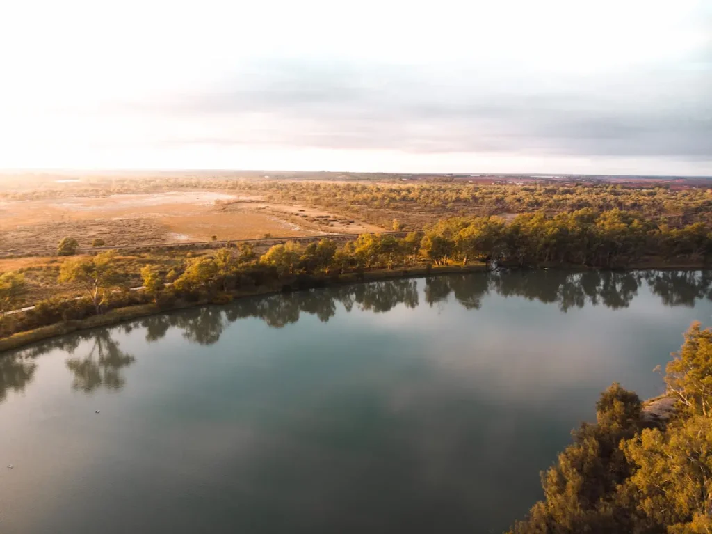
Situated on Kimberley’s central north coast, the Cambridge Gulf wetland region spans a variety of conservation reserves that act as critical Dry season refuges for waterfowl and wildlife.
n
Ord River and Parrys Lagoon Nature Reserves, as well as the Osprey Coastal Park, attract over 80 migratory bird species.
n
As seasonal floodwaters contract into billabongs and claypans, magpie geese arrive by the thousands to join legions of ducks, jabirus, egrets and brolgas, all feeding voraciously during the peak months of June through September.
n
The adjacent Lake Argyle, Australia’s second-largest reservoir, fosters barrage fish like barramundi, sooty grunter and the odd rumoured monster silver cobbler specimen exceeding 30kg!
n
Multiple access options exist for hunters, starting with the Gibb River tourism road, which traverses the Osprey parklands. For deeper access, the 4WD-only Purnululu Track winds down to Lake Argyle, while unimproved tracks also enter the Ord River Reserve.
n
Permit required to navigate the Parry’s reserve and lagoons area. Come well-equipped and self-sufficient to explore these expansive marshland ecosystems.
n
Prince Regent River Reserve
n
Protecting the southern shores of St George Basin where the mighty Prince Regent and King George Rivers empty into the Indian Ocean, this 1,000 sq km reserve occupies a remote coastal margin between threatened mangrove habitats and the rugged Mitchell Plateau uplands.
n
As Wet season monsoons swell the river networks, storm surges propagate up tidal creeks and inundate surrounding flats, providing nutrient-rich feeding zones that support prawns, fish and molluscs.
n
When waters retreat through the Dry, this bounty, in turn, draws crocodiles, sharks, sawfish, cod, barramundi and mud crabs concentrated into shrinking pools awaiting next Wet’s arrival.
n
For hunters, the main attraction remains magpie geese and green pygmy geese gathering amid the mangroves and tidal flats as migration reaches its peak during May and June. However, access remains extremely difficult, with mostly boat access possible.
n
Consider flying or boating into the harbour from Kalumburu, then navigating the lake network as far upstream as depth and crocodiles allow!
n
Drysdale National Park
n
Sprawling east from the Gibb River Highway across over 6000 sq kilometres of remote Kimberley inland, Drysdale River National Park encompasses diverse landscapes ranging from high red sandstone cliffs and river gorges to rugged uplands transitioning gradually towards open Eucalyptus woodland savannahs.
n
This habitat diversity, combined with permanent springs scattered throughout the park, attracts diverse wildlife. Coastal areas host migratory shorebirds and tropical species like jabiru, magpie goose, egrets and herons.
n
Inland waterways and billabongs draw freshwater crocodiles, flying foxes, corella and cockatoo flocks drinking side by side.
n
Throughout the transitional woodlands, bustards, turkeys, quail, finches and parrots of many colours concentrate around scattered waterholes as temperatures climb and humidity drops in the approach to the Dry season.
n
The park even protects small pockets of monsoon rainforest lined with Livistona palms and cycads through gorges carved by Kalumburu and Drysdale rivers.
n
The remote 4WD-only Purnululu track connects the National Park across towards Kununurra, while similarly challenging roads penetrate east through Pentecost river, crossing over to Lake Argyle.
n
Alternatively, consider chartering flights onto remote airstrips like Mitchell Falls to establish hunting base camps. Come well-equipped for self-sufficiency and prepared to expend effort reaching remote interior areas.
n
Pilbara Tablelands & Desert Wilds
n
Oases Amidst Australia’s Arid Heart
n
Westwards inland beyond coastal and Kimberley wilds, the Pilbara region occupies the arid tropical zone showcasing spectacular landscapes where rocky debris tumbles from table mountain ranges down onto sweeping plains clad by spinifex and wandering dunes.
n
Here, the hunting focus shifts from wetland species to those uniquely adapted to survive unrelenting heat and drought.
n
Hardy fauna persists by using scarce permanent oases, hidden gorges and isolated waterholes scattered thinly but life-sustainably across one of Australia’s most inhospitable yet starkly beautiful wilderness expanses.
n
Millstream Chichester National Park
n
The Pilbara tableland’s northern extent rests along ranges bounding vast marshlands fed by cyclone rains sweeping south from the Indian Ocean.
n
Millstream Chichester National Park sprawls out from the Chichester escarpment, sprouting suddenly 600 metres above the arid plain.
n
This fertile range harbours gorges watered by the Fortescue River, creating arid microclimates supporting lush pockets of vegetation that concentrate wildlife through the Dry season.
n
Of main interest for hunters, these habitats attract bustards, painted button quail, parrots and hill turkeys coming to drink from the Permian springs scattered amongst Parker and Python pools.
n
Species mix with endangered rock wallabies, dingos and euros, sharing the shelters and foodstuffs hidden within rugged splits carved through ancient peaks.
n
Hunting access requires care to avoid damaging fragile cryptogamic soil crusts that retain sediments stabilising scattered vegetation. Consider joining a tag-along tour to navigate sensitively off-tracks while seeking out wildlife populations.
n
Rudall River National Park
n
Further inland from Millstream Chichester on the Great Sandy Desert’s southern edge, Rudall River National Park equally mixes limestone karst chemistry with ephemeral desert hydrology to create scattered lifesaving springs, soaks and palm-shaded rock holes.
n
Spanning over 1.3 million hectares of interconnected sand plains, salt lakes and occasional ridges protruding above the dunes, Rudall River National Park suffers extreme temperatures spanning over 50 degrees Celsius range across seasons.
n
Yet determined explorers can achieve spectacular remote hunting, finding cliff-dwelling rock parrots, spinifex pigeons, honeyeaters, thick-billed grass wrens and other arid-adapted species concentrated around tiny pockets of water.
n
One must, however, travel completely self-sufficiently on Such remote excursions, capable of driving hundreds of sandy kilometres without encountering any facilities beyond scarce bush camps.
n
Consider joining an indigenous cultural tag-along tour to learn tracking and survival skills while contributing to the park’s habitat conservation initiatives.
n
Karijini National Park
n
West from Rudall River, nearing the Pilbara’s interior, Karijini National Park has become one of WA’s most iconic landmarks, showcasing breathtaking table plateaus split by sheer gorges carved through high ironstone ridges concealing hidden waterfalls and emerald pools far below in the shadows.
n
Most visitors sensibly avoid the midday heat by exploring the gorge country as temperatures peak above 40 degrees.
n
For hunters, however, this heat-enforced inactivity provides ideal moments to stake out water sources quietly observing wildlife movements.
n
Here, Hill turkeys, rare night parrots, red-browed pardalotes, chattering spinifex birds and red-capped robins all gather to drink from scarce waters.
n
Kangaroos shelter under peak shadows while birds of prey constantly circle overhead on thermal winds, hunting relentlessly for small birds, reptiles and mammals visiting the same waters.
n
Choose lookouts to avoid heat and glass waterholes carefully using quality binoculars. Alternatively, crest a ridge at dawn or dusk when a cool breeze may also bring out kangaroos.
n
Time your explorations for May through September, when most surface water disappears across the arid lands.
n
Heading To NT? Read: The Best Hunting Locations In Northern Territory
n
Interior Arid Zone Hunting Opportunities
n
Beyond the Pilbara tablelands, the land gradually merges into sandier desserts where dunes begin overtaking underlying geology obscured by drifting red sands.
n
Rainfall drops below seasonal reliability thresholds to levels classified as extremely arid. Yet for the patient hunter, biological treasures here persist through evolutionary resilience.
n
Great Sandy Desert Expedition Prospects
n
Occupying a vast expanse spanning some 250,000 square kilometres of western desert between Port Hedland and Warburton, the Great Sandy Desert represents one of the largest cohesive regional blocks on the Australian continent.
n
Straddling the headwaters of the legendary Canning Stock Route, its southern extent merges into the Gibson and Great Victoria deserts, holding systems the size of England completely uninhabited by humans beyond a few isolated well bores and remote communities.
n
The Great Sandy’s sheets of longitudinal dunes, occasional marshes and sandstone massifs support remarkable wildlife like the endangered night parrot, rare marsupial moles, Australian bustards, thick-billed grass wrens and princess parrots, all persisting by using temporal rock pools and soaks.
n
Explorers may discover rare relic populations of wildlife pushed to refugia edges adapting to increasing aridity wrought by our changing climate.
n
Yet access constraints remain stringent for such fragile habitats, requiring permits for travelling responsibly across Aboriginal Trust Lands and vulnerable dune systems.
n
Consider supported tag-along tours operated by Traditional Owner Ranger groups from Warburton or Birriliburu Indigenous Protected Area to arrange access while minimising vehicle impacts.
n
Travel only in small supervised groups equipped for self-rescue and practice leave-no-trace principles to protect natural water catchments and vegetation, stabilising these desert environments.
n
Gibson Desert Oases
n
The Gibson Desert Nature Reserve encompasses remote expanses inland from the Warburton Community adjoining the WA/NT border.
n
Features include isolated mesas, sandstone ridges and expansive dune fields interspersed by claypans, which fill episodically to create temporary wetlands after scarce rains.
n
Given extremely limited access and lack of permanent surface waters across most of Gibson Desert, wildlife depends on soaks surrounding low ridges and trickling cave seepages collecting rain runoff.
n
These isolated oases allow the persistence of highly specialised arid zone animals found only sporadically across central Australia’s deserts.
n
The large Australian bustard, for example, scours kilometres of dunes between infrequent rains, surviving three years without drinking. Rare central hare wallabies and Australian feral camels traverse similar nomadic desert pilgrimages.
n
Other elusive inhabitants like the night parrot and thick-billed grasswren remain undiscovered across unexplored swathes of the Gibson Desert hinterland.
n
Astronomical night skies sparkle brilliantly in cloudless dark hours above camps situated far from any distant settlement lights. Temperatures fluctuate over 40 degrees daily, from winter nights dipping below zero to typical December days exceeding 45 degrees Celsius.
n
An approach such challenging environments and remote journeys only in guided tours operated by highly experienced leaders and local indigenous protectors of these extraordinary desert landscapes.
n
n
Southwest WA: Forests, Farmlands and Coastal Sanctuaries
n
The temperate southwest corner of Western Australia delivers fantastic hunting opportunities less than a day’s drive from urban conveniences yet feeling worlds apart.
n
Cooler year-round Mediterranean climates here nourish dense Karri forests, expansive heathlands and rich farmlands cycling through a distinct wet winter into a hot, dry summer pattern.
n
Numerous timber reserves, national parks, nature reserves and private farmlands provide hunting access across the Southwest Land Division stretching from Perth to Albany and northwards inland to the Wheatbelt.
n
Wellington National Park
n
Part of Australia’s largest forest parkland spanning nearly one million hectares, Wellington protects over 50,000 hectares of Karri forest along the picturesque Collie River inland from Bunbury.
n
These towering tree environs conceal prolific marsupials like western grey kangaroos and common brushtail possums, brush turkeys, plus multiple introduced deer species. Access through multiple entry points of the South Western Highway.
n
Lane Poole Reserve
n
Encompassing nearly 50,000 hectares of habitat stretching south along the Harvey River inland from Nanga Brook to Kirup, Lane Poole contains stunning tracts of tall Karri / Marri forests interspersed by thickets of paperbark lining the river course.
n
An estimated 400 western Grey kangaroos shelter here, along with European Red Deer, Emus, Australian Bustards, Brush turkeys and Bobucks. The reserve connects to the vast Julimar State Forest. Access from South Western or Brookton Highways.
n
Boorabbin National Park
n
Representing the northernmost extent of the expansive Avon Wheatbelt inland from Southern Cross, Boorabbin National Park’s salt lakes, sand plains, and York gum woodlands harbour incredible seasonal waterfowl numbers, estimated at over 80,000 in peak years.
n
Other species on offer include western grey kangaroos, emus, bustards and wild pigs. Access via Great Eastern Highway.
n
Coastal Sanctuaries
n
Extending from Cape Leeuwin towards Esperance, these shorelines represent Australia’s only temperate coast facing the Southern Ocean. Rocky coves, beaches and tidal estuaries here attract seabird colonies, shorebirds and endemic mammals to fish-rich pools sheltering from powerful storm surges. Prime destinations include:
n
Stokes Inlet Marine Park
n
Protecting extensive tidal mudflats, sandbars and eelgrass meadows feeding into Stokes Inlet south of Esperance, these estuary environs represent essential feeding and nursery habitats for juvenile fish and crustaceans that, in turn, support thousands of hungry bird arrivals during summer migrations.
n
Look for Caspian terns, crested terns, red-necked stints, eastern reef egrets, red-capped plovers and more. Access from Merivale Road and connective bush tracks.
n
Waychinicup Estuaries
n
Encompassing pristine tidal zones around Cheyne and Waychinicup inlets between Albany and Cape Riche, these wetlands provide protected roosting for Hooded plovers, red-capped plovers, stilts and sandpipers that hunt endangered honey possums amongst coastal thickets.
n
Connects through to Mt Manypeaks reserve. Care is required to navigate proliferating tidal channels by small boat.
n
n
Conclusion
n
Realising successful WA hunting means understanding challenging landscapes and acting respectfully as guests. Follow Parks and Wildlife management guidelines, minimise lasting environmental impacts and appreciate the privilege of these experiences.
n
Obtain required licences, permits and equipment tuned for extended remote travel while self-reliantly carrying ample provisions across vast distances between any re-supply points.
n
Stick to designated vehicle tracks, conserve fragile ecosystems from firewood collection/ rubbish and avoid spreading pests and pathogens between bioregions on your hunting gear. Through wisdom and care, WA’s wild beauty shall endure, rewarding future generations equally.
n
n
The post Best Hunting Locations In Western Australia appeared first on WA Travel.
n